Showing posts with label spatial cognition. Show all posts

November 22, 2012

is there a space in cyberspace for geography ?

Searching and searching for everything and anything we still haven't found and if already found then searching how to reconstruct and reinvent. Like the new urban image the WIFI-scape or Urban terrain as the Norvegian YOUrban group calls it.
That's who we want to be - the Inventors.
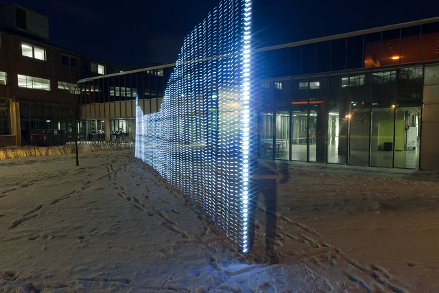
LightPainting WIFI from YOUrban group (http://yourban.no/)
And so we need more 'space' for Inventions, and so we expand it! Expanding spaces, realities, cognition.. 
Does this expansion affect us as individuals, as society? Does it also expands our research raising new questions, opening new fields or even forming new sub-sciences or indeed it just let us create new terms and subjects to manipulate about the the same things like spaces?
Such questions grew up after reading an article about the Geography and Cyberspace by M. Graham. Indeed an interesting and easy to go article well presenting the background or the 'hi-/-story' of a cyberspace. What the most interests me is the relation of cyberspace with geography. As it's clear geographers don't seem interested in this topic (no big research done) at all, but as the author tries to prove they should be, because the cyberspace as itself is a sort of space and therefore it should also be reviewed from geographical perspective.
At that point it seems for me that the article is written in as much serious as with a slight ironic mood

June 24, 2011

visual information cognition: spatial visualization in 3D with GPlates

Obtaining more data and developing methods of analysis, scientists in parallel are working on information visualization as it is the most perceivable and comprehensible way for humans anyone would tell. The visual cognition (visual analysis like perception, acquisition, memorization, of shape properties and spatial relations) is remarkably flexible and efficient (Ullman 1996).

Map creation with Matematica

I believe there is a number of research  in visual spatial cognition done to prove I've just stated above. One research in 3D vs 2D proves that 3D increases the spatial memory, what means one is able to remember at least longer. (Cockburn, 2004), although in general it is very hard to prove something about our brain using the same brain itself.

Indeed, I am not going to argue here if 3D is better then 2D or that visual information is perceived better than textual, as more research on this topic should be done from my side. But all I want to notice, that more and more softwares are developed for spatial information visualization.
If you have a look at the geoweb side, many applications recently launched has a graphical visualization. Statistics are no longer presented as a bunch of numbers, visual interface is developing,as example Gapminder, or new visualization package, google visualization api package in R software.
Map making has reached the peak already - everybody can do it from simply route creation on Google Maps or Google Earth, to table visualization using Google Fusion Tables, or such geoweb applications like GeoCommons, or we can jump to professional map creation and visualization. Already existing desktop applications that help to visualize data are often updated, besides new desktop softwares with an amazing visualization arise.

Let's have a look at such hard subject as plate-tectonics and it's visualization.