Once I was already writing about geo-socializing as telling your location for everyone, for a reason of creating like virtual community out of internet users with similar interests. Anyways I still would believe that "Man is by nature a social animal" as Aristotel stated.
But maybe it isn't just that anymore? Maybe now we really are approaching or comming into a cyborg stage? Forget the interests, connect to new broadband and catch the feeling of being important an known! Tell the whole world about yourself.
Now one can do that even through a WIKI!
Have you ever wondered if there are Wikipedia articles about things near you? Well, wonder no more! Today, we present the GeoData extension for MediaWiki, which now provides a structured way to store geo-coordinates for articles, as well as an API to make queries around this information (wiki blog).
Yes, it is experimental, and it's mostly just for seeing near-by articles. But would such aim remain in this open sphere? I wonder how will this function emerge or 'mutate' when people will start playing with coordinates and geo-tagging in this Encyclopedia.
The idea of media transforming socially and spatially is flowing around for the past decade already. In 2001 great GIS scientists M. Goodchild and D. Sui has published a short remark titled "GIS as media?" on International Journal of GIS. Over-viewing the latest developments in GIS then, authors have felt the need for fresh conceptualizations for what GIS actually is and will become in the near future. Observing growing relationship between GIS and society authors had proposed that new concept: GIS as new media.
Some time before I was scribbling in my post about media and geography, how journalists 'found' geography. But it was just a quote from Economist, not knowing about this concept existing between scientists. So, let's have look further.
For the purpose of security, that natural feeling inside us, a human needs to know his location, in a general sense, with a relation to the environment usually. For the same security purpose, kids are always asked to tell where are they going, where will they be, sometimes the adults as well. But it's just within communities.
In today's web world, new virtual communities have a possibility to upraise, merged from the people you know well, you've just met or have never met.
How much is it important to tell your location for your virtual community? It's not for security, but for what? Meeting new people, showing yourself or just playing with virtual power? There is some reason, as more then every tenth smartphone user likes to announce his location!
A Pew Internet Project report released today represents at least a modest victory for Foursquare and similar services, finding that 12 percent of smartphone users are checking in via location-based apps. (clickz.com)
The project report called such phenomena geo-social.
It would be interesting to find some research done or to do one on what role plays that geo-socializing?
Some time I was questioning why do we/I need to know history, the history of family, nation, humanity. Why we always look back? And once I found - people, indeed society, has such thing as collective historical memory, that is built in our heads from our experiences as a group by sharing and it talks us about our culture and identity. The concept is quite clearly explained in wikipedia (Collective memory), as well as there is a free document from Wesleyan University in Middletown, Connecticut to read (Study of historical memory).
We do not notice that most of the historical memory we have is a collective, it's a shared memory - not collected empirically. What is interesting that with growing society people are searching for more and more earlier and broader historical memory. We can see that even from mass-media production, which from being interested in fantastic movies some decades ago are now presenting the documentaries, probably that is what the society is asking for - the collective history to share. And it is not just the trend of media information, I feel it is the trend in geographical information. For the places, spaces with great amount of geographical information that is well represented (mainly visualized), the historical geographical information demand is raised more and more often. It's all about the curiosity and about the desire of collective historical memory.
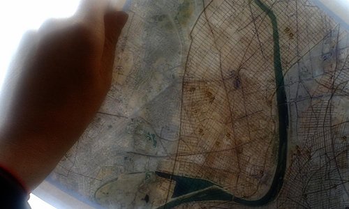
The historical geographical information representation is a part of reconstruction process, it's a spatial reconstruction process. Not long time ago, there was a movie made by Deutsche Welle about the reconstruction of the Berlin wall - I wrote about in the previous post. Now, the new project is published and presented for the society - the Early Washington Visualization done by Image Research Center (IRC).
The project can be found and is fully described on http://visualizingdc.com/
But let's have a look at the geographical/cartographical side of this project.
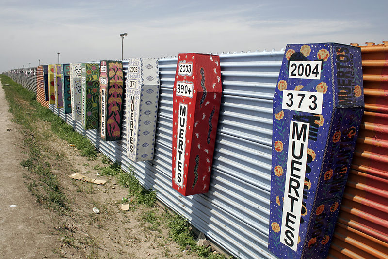
There are many boundaries in the world, one of the most official ones in big scale are borders, in other words, political boundaries. How often do we confront with boarders personally? How do we understand them socially?
It is very hard to generalize the notion of border as it depends on us and on the boarder we confront with, but there is a common, social agreement on boarders, their visualization - political map, their definition - laws, their realization - boarder surveillance constructions. There are so many different understandings about the border that it makes boarder variable!